In 2010 after I moved back to New York I wanted to keep hiking long trails but knew I had to keep working and couldn't take time off to go hiking for months on end, so I started working very slowly on the New York Long Path. It was the closest long distance trail to where I lived in Albany, NY and it was relatively unheard of. I had grown up in the area and I had never even heard of it myself until I crossed over it while hiking on the Appalachian Trail in 2005. So 5 years later, I started at the northern end of the trail in Thacher Park near Albany and slowly started doing 7-20 mile sections working my way south. Originally I thought I would be able to do it in at most 2 summers, but it wound up taking me part of 7 actual seasons to complete. This year I knew I was going to try to head back out west to the Pacific Crest Trail, so I wanted to make sure that I finished the Long Path first. I had just under 50 miles left going into this season, so it was very doable. After getting a couple sections done in late April, I knew I had to try to plan out my days off to get the last couple sections done. I decided that I wanted to try to invite as many people who had hiked any part of the trail with me over the years to come along on the last hike. So a few weeks in advance I set up the date of Sunday, May 29th hoping that people would be available and that not knowing the weather in advance it would turn out to be a decent day.
I was lucky that I was actually able to get 3 friends who were willing and able to come hike along with me that day - Nat Beyer, Meghan Ruby, and Mark Schilling, We all decided to meet at 8 AM to leave Albany (despite me working my last close at Friday's the night before and not leaving work until 2 AM). Everything worked out well, and we were on the road by 8:10. First we would drive all the way to Fort Lee National Historic Park on the New Jersey side of the George Washington Bridge. There we left my car and all crammed into Meg's SUV and drove back north to the headquarters of the Palisades Interstate Park Commission where me and Meg had hiked to the week before. It was going to be pretty hot with expected temperatures reaching into the 90's. I also had committed myself to carrying a fully loaded backpack as my first real walk with weight in prepping for my trip out to the PCT the following week. So we arrived at the PIPC Headquarters just after 11 AM and were on our way south shortly after.

I knew that this section of actual trail was going to be pretty easy compared to a lot of the other sections I had done. It basically ran for about 8.3 miles right along the Hudson River in the New Jersey Palisades. No major ups or downs and for the most part completely covered under the forest canopy. The only really negative part about this section is that it follows within about 100-200 yards of the Palisades Interstate Parkway most of the way so you get to hear and see the highway through the woods pretty much the whole way. Every once in a while however the trail would come close to the cliffs along the river and we would get really great views of the river and of the Bronx and Upper Manhattan on the other side.


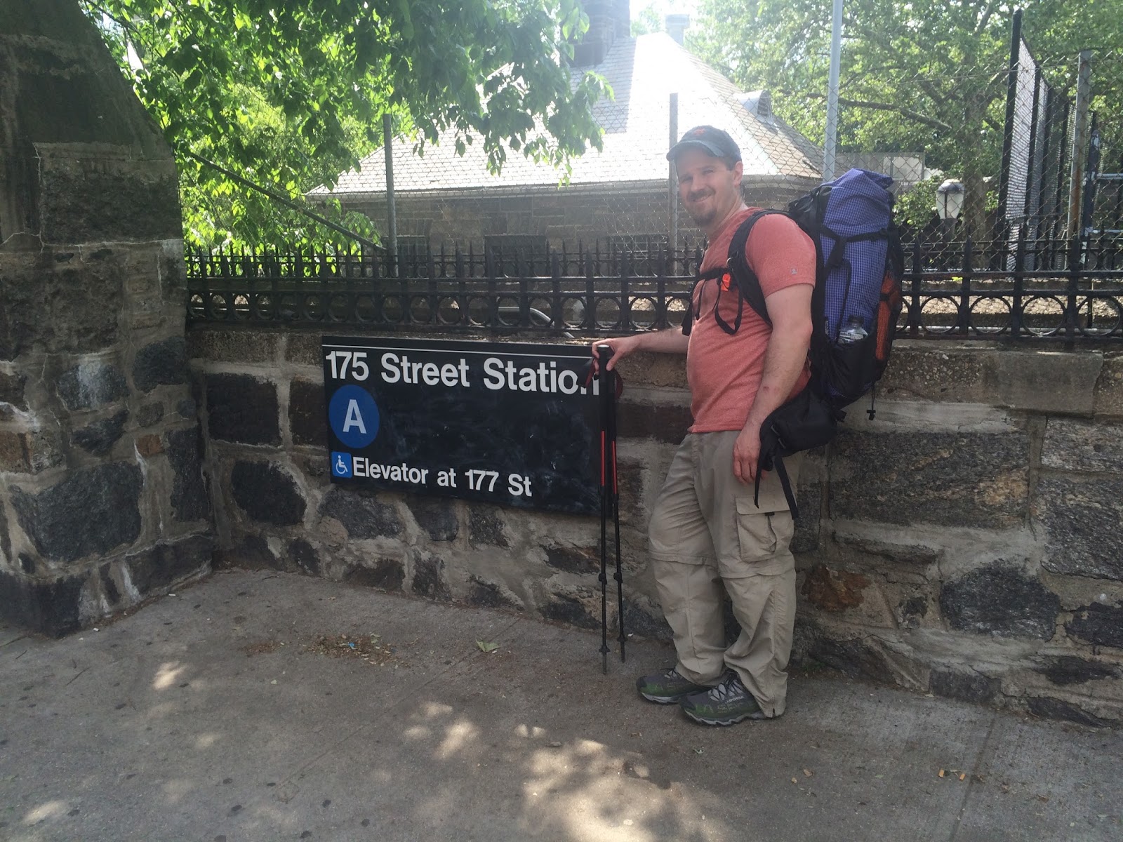
As a result of the relative flatness of the trail we were able to make really good time and made it to the George Washington Bridge at about 2:30. One of the nuances to hiking a long distance trail in segments over the course of many years is the sometimes changing aspect of the trail itself. Reroutes are a constant thing from year to year on these trails, sometimes temporary and sometimes permanent. For 6 years I studied every aspect of this trail while planning for this day. For 6 years the end of the trail had been at Fort Lee National Historic Park and I couldn't wait to get there. However, sometime over the past winter the New York/ New Jersey Trail conference (which maintains the trail) decided to change the southern terminus of the trail across the George Washington Bridge into Upper Manhattan. According to the Trail Conference website (http://www.nynjtc.org/book/1-george-washington-bridge-nynj-state-line) the trail now ends at the 175th St. subway station and added about 1.5 miles onto the end of the hike. So even though I was at the end of the trail from all previous years, I still had a little farther to walk. We had all questioned what the walk across the bridge would be like as we hiked that day, and it actually proved to be much cooler than we expected. The walkway across the bridge was actually a very popular walking and biking route and we actually probably passed about 500 walkers, runners, and bicyclists between both crossings of the bridge.


We had spectacular views of downtown Manhattan as we walked across the bridge and once on the other side it was a quick walk to the current "official" terminus of the trail. The one catch was that even though the trail had been rerouted there, apparently the conference had not caught up with actually marking the route there or making any sort of recognition of the official end of the trail so I had to take my best guess as to the actual end of the trail.

After getting some authentic New York City pizza and a bathroom break, we made our way back over the bridge and continued around the corner to the original southern terminus and where we had parked my car at Fort Lee. The aqua blazes I had followed all the way from Thacher Park near Albany picked back up on the original route and led us right into the park and towards a more deserving end point.

According to the website as of this hike only 139 people had officially applied to be recognized as hiking the whole trail to completion. It is a real shame because there are some truly amazing sections of this trail and still nobody knows about them. This hike over the years has been a true labor of love and I am so glad I was able to share this day with most of the people who made it possible over the years.
If anybody is interested in hiking parts of or the entire trail, here is an interactive link that will show you a map of the trail: http://www.nynjtc.org/book/overview-map-and-overview The map is still a little out of date as it doesn't include a couple reroutes over the last couple years (including the southern terminus change), and it also shows the plans to extend the trail north from Thacher Park to Northville, NY to link up with the Northville/Placid Trail. However, right now the official trail still ends at Thacher Park. If the trail is one day officially extended north I will most likely go hike those miles as well.
So whats next? Now that I have finished the Long Path it is time to set my sights back out west to continue working on the Pacific Crest Trail. My last day of work at Friday's was yesterday and on Sunday (June 5th), I will be getting on a train and heading out west to work on another long section of that trail. The next post I plan on having up within the next 24 hours will comprise of my tentative schedule and my list of expected mail drop locations for anybody who is interested in sending me any goodies or letters (I actually love receiving letters on trail). After this post this blog will become official and I will let everyone know that it exists. I hope you will follow along with me this summer as I head west and get to share my adventures with you....
Keep on Keeping on......
Patch (AKA Todd)