Wednesday, July 25, 2018

7/19/18 - Day 11 - PCT/Crater Rim Trail Junction to Mazama Village

Daily Miles: 13.8
Total Miles This Hike: 194.1
PCT Miles Covered: 1895.7

What a day.  Wow.  Just WOW!!!!  You can look at pictures of Crater Lake or see it on TV, but nothing can do it justice.  By far one of the top 5 most beautiful places I have seen.

There were a couple things I misjudged today about the actual hiking though.  The first was that even though I had been to the highest point of the PCT two days ago, the rim trail alternate was not technically the PCT and the Rim Trail went about 200ft. Higher than the highpoint.  I didn’t have an elevation profile for it, and didn’t realize I had to climb almost 1500ft vertical just to get up there this morning. Once I did though here is a taste of what I saw:


Crystal Clean skies this morning.  I had worried the smoke from the last couple days would ruin the view.  Near the end of the walk around the rim, I did see a fire off in the distance which must be the cause of all the smoke.


The second thing I misjudged was the actual trail around the rim.  For some reason I imagined a paved walkway with lots of pullouts for cars and scenic overlooks for people to take pictures and take a walk.  There were some of those but the rim trail itself just went up and down over and over again leading into Rim Village which is where there is a store and cafe and visitors center.


After a quick snack and soda from there, I now had to come down off the rim, reconnect onto the PCT and hike another 4+ miles into Mazama Village which is the official campground of Crater Lake.  It was a big national park campground with a campstore, showers, laundry and $5 tentsites for PCT hikers.


There were about 10-15 hikers by my count there, and I got to spend some more time chatting with northbounders.  Got all the essentials done including picking up my second resupply box.  The smoke started to come back with a vengeance into the valley tonight.  A couple northbounders also heard there was yet another smaller fire southwest which was sending us all this smoke and that they heard rangers were closing off trails.  I kept seeing hikers come in though and asked all of them if the PCT was safe or in any danger of being closed and they said that they didn’t see or hear anything.  I figure I will just stop by the ranger station kiosk on my way out tomorrow just to make sure.  

Tomorrow will be my longest day yet, as I know there is no water for 20 miles south of here and I will have to at least make it that far through apparently another long burn area as well.  My hope is to be out as soon as the ranger kiosk opens and I get the ok.  What an outstanding day today was.  Last couple days were kinda blah and ho-hum but today completely changed all that.

Keep on keeping on

Patch

7/18/18 - Day 10 - Diamond Lake Hike/Bike Campsitr to PCT/Crater Rim Trail Junction

Daily Miles: 14.8
Total Miles This Hike: 180.3
PCT Miles Covered: 1878.2

With the newly found cell service I had at this hiker/biker site from the night before, I decided to take my time getting out of camp and use it for all I could.  I called home when I woke up and messaged my cousin again who I was hoping to meet back in Ashland.  Unfortunately because of circumstances out of his control, he wasn’t going to be able to make it up to visit and travel with me to Bend.  As a result I decided to take a couple hours while I had service and try to nail down accomodations and travel arrangements from Ashland to Bend now, so I kind of had a timeframe set in my head of where I needed to be when.  Plus who knew when I would get service again and didn’t want everything to be booked or skyrocket in price if I waited till I got to Ashland

I looked into a rental car again, but for some reason the exact same car, for the same duration, on the same day of the week I booked it before was now almost $250 whereas it had been $115 three weeks prior.  I decided to look at Greyhound and it was $54 from Medford to Bend going through Eugene.  Only problem was it left Medford at 5:05AM.  This meant I would have to be in Medford already the night before the bus ride.  So I booked a hotel a mile from the bus station for the 26th.  That gave me 9 days to hike 130 miles.  Plenty of time but enough leeway in case something came up or I had to take extra time to roadwalk around the fire closure.  Then I booked 3 nights (27th-29th) back at the Bend Hostel.  Cheaper than a hotel, but I was hoping now that I knew they had a hiker hammock rate, when I get there I was gonna see if I could just pay for the hammock out back at $25/night instead.  Then I would head back to Sisters and Santiam Pass on the 30th.  5 days behind my original itinerary.  Might mess up finishing on my birthday, but you never know how many miles I might be able to make up.

By the time I got all of that done it was 11AM, and I headed out towards the Diamond Lake Trail back to the PCT.  Just like the Howlock Trail yesterday this trail was not used much and very overgrown.  Finally I arrived back at the PCT and another amazing Devilfish water cache.  I never realized before coming back out here water would be such an issue in Oregon.  I was basically hiking another 9 miles to another water cache inside Crater Lake National Park.  


The one in the park technically shouldn’t be there but the rangers apparently look the other way.  There was definitely smoke in the air all day today as one of those lightning strike fires must be in the area blowing smoke all over. I finally arrived at the PCT/Rim Trail junction where I decided to camp.  


Tomorrow I will take the Rim Trail alternate (hopefully the last alternate for a while) up to the rim of Crater Lake and enjoy a day of magnificent views I have been looking forward to for 10 years now.

Keep on keeping on

Patch

Friday, July 20, 2018

7/17/18 - Day 9 - Maidu Lake to Diamond Lake Hike/Bike Campsite

Daily Miles: 17.45
Total Miles This Hike: 165.5
PCT Miles Covered: 1858.3

Today started out with a solid plan but now at the end of the day I appear to be walking into the unknown.  Again.  I didn’t make my 6:30AM goal but I was out of camp by 7:15.  As I was leaving the lake I snapped this picture of a mother duck leading her babies through the water.


I had about 300 feet in elevation gain to get back to the trail from the lake, then another 1200ft to get to the highest point of the PCT in Oregon.

I was making great strides to get up the hill when once again I found myself taking a break and finding cell service.  I checked the Klamathon fire status again and it had inched up to 96% contained.  Slowly but surely they were getting it out.  My hopes for this southbound gambit working were as high as ever (my ultimate mistake of the day).  Not to repeat my long internet service break from yesterday, I assumed that the higher I got the better the service, so I kept going.  Finally I reached the top of the hill and the highest point of the PCT in Oregon (and Washington) making this the highest I will be this trip.


It was actually a little windy up there, and my assumption of better service was wrong as I now had NO service again, so I didn’t break long and started to head down the other side.  About 15 minutes later my day went from great to very stressful once again.  I bumped into another female hiker and we chatted for a few minutes.  Remember when I was so excited when it rained 2 days ago?  Well apparently the thunderclouds that went through set off up to 50 lightning strikes in southern Oregon and many small fires had popped up.  Great.  Just Great.  She said that she could see smoke through the valley yesterday and this morning, but had no clue of the severity of the fire(s) or how close they were to the PCT.  This plan was gonna work dammit.  If I make it all the way back to Crater Lake with the ability to get back and cover the closed miles of the Klamathon fire just to have another fire pop up and stop me before I get there, so help me god.

This only increased my speed and drive to get into Diamond Lake as fast as possible.  I needed to find out any information I could as fast as possible.  I soon came to the Howlock Mountain Trail which lead 7 miles down hill to Diamond Lake.  This trail definitely isn’t used as much at higher elevations as I was going over and around a lot of blowdowns and there were sections of trail it was so faint I had to look around a lot to double check I was still on the trail.  About halfway down it I got my first real view of Mt. Thielson.  This mountain is a truly epic solitary mountain to behold.


Shortly after I came to Thielson Creek which is melt off of the glacier snow that resides on Mt. Thielson.  The PCT crosses Thielson Creek at a much higher elevation that where I was at but the water was so clear and so cold I decided to take 2 liters even though I probly didn’t need it.

About a mile later the trail turned to literal sand as it merged with a horse trail that had been all dug up by hooves.  The lower I got in elevation the hotter the sun became as well.  I finally arrived at the road that leads into Diamond Lake praising myself for the decision to grab an extra liter of water.  The plan was to stop really quick in the resort and walk another 3 miles to the south end of the lake where there was a pizza joint with a TV to watch the All-Star game and a free hiker/biker campsite around the corner.  The mileages I had been given were a little off I think as I think I did between 1-2 miles extra once on the road just to get to the resort.  Then, after walking north to south, the resort entrance headed in and backtracked about a halfmile north, so I just decided to skip the resort and head to the pizza place.

Even though I was fully exposed now I didn’t have to walk on the road.  There was a paved bike path that lead from the resort and into another attached pay per site campground, then I just followed the campground roads all the way to where the campground ended and the bike path began again.  The entire time walking next to the lake I could hear planes and helicopters (obviously using the lake for water drops on whatever fire was near) and I could see the light haze of smoke through the valley.


Finally the bikepath dropped me off right in front of South Shore Pizza.


I proceeded to order the Diamond Lake 12” special which was a bit pricey, but I made up for it by drinking about 12 mountain dews.


During the game I chatted up an older couple trying to find out about the smoke (because guess what?  I had no cell service).  They said they didn’t know but they came in from the southeast by Klamath Falls and they said there wasn’t any down there.  Nobody who worked in the restaurant had any clue either. Believe it or not this actually made me feel a little better.  If there had been another big fire like the Klamathon fire around, people would know and be talking about it. There probably is a fire close by but its probably really small right now.  The Klamathon fire blew up faster than I have ever seen, but they all don’t do that.  

So I sat and watched the game through the 9th inning even though the National League tied it up in the bottom of thr ninth.  It was 8:45, getting clise to dark,  and I still had to go find the hike/bike site and set my tent up.  Plus the restaurant closed at 9PM and after being the for almost 5 hours, I don’t think they really wanted me to hang out for extra innings.

So I packed up and took off and actually was a lot closer to the site than I thought at the restaurant.  Absolutely free with tap water and flushing bathrooms.  Not Bad.  I layed down after setting my tent up and checked one more time and boom I had service.  Must have stayed up till well after 11PM (very late for a hiker) checking out fire info (no big ones close by.....phew), the news, sports, facebook and all.  Unbelievably I still didn’t have good enough service to upload blog posts.  I could do them without pictures, but I really think they would be boring (more than normal) if I did that.

Finally up to date on all things important, I passed out.  Tomorrow should be relatively slow and easy as I make my way into Crater Lake National Park.

Keep on keeping on

- Patch

7/16/18 - Day 8 - Windy Lake to Maidu Lake

Daily Miles: 17.45
Total Miles This Hike: 148.05
PCT Miles Covered: 1851.5

Remembering the weather reports I was able to see in Shelter Cove, today was the day the temperature was supposed to rise into the 90’s.  I knew I had water if necessary in 2 seperate spots along the trail today but just decided to get out early again and take my time.  Having taken the Oregon Skyline route, I gained a little bit of leeway, and there is no rush to push big miles yet.  I had set a date to meet my cousin in Ashland on the 26th, so all I really needed to average each day was about 15 miles to get there on that pace which is less than the 16.8 I have been doing from the start.

As I pulled all my stuff together I realized I was missing something (minor) for the first time.  I had been keeping my bug net in my pocket all day as a quick response tactic and I still had it there, but the stuff sack for it was nowhere to be found.  Last place I remember shoving it was in my hip belt pocket with my phone the day before but now it wasn’t there.  It must have fallen out somewhere yesterday when I pulled my phone out to check for service or to use Guthooks app.  It’s no big loss, but I hate the fact I dropped it mid trail and somebody else had to walk by and pick it up to dispose of it.

I decided that I had enough water to get to the water cache at Windigo Pass, so I only carried a liter out of camp and continued to finish the Oregon Skyline Trail as it came out on Forest Service Road 60.  About 6/10th of a mile up the road the PCT reconnected at another outstanding water cache maintained by Devilfish.  Water caches are places where trail angels bring gallons and gallons of water and leave them for hikers that are going through the area.  Usually these are only needed in long waterless stretches such as this one and Southern California.  Devilfish is the same trail angel that I remember stocking the caches 2 years ago when I was walking through the northern reaches of the mojave desert.  He must spend a couple months down there, and then travel up here and spend a couple months doing the same.  What an outstandingly amazing human being.  By my count there must have been over 150 gallons of water at this cache.  


The section south of here for me had water just over 6 miles in at a spring that was about .4 miles off the trail and about 300ft down in elevation, or at just after 12 miles where there was a side trail down to Maidu Lake.  The lake was .75 off the trail which most hikers wouldn’t want to spend the time hiking down to.  I however had already planned on staying there tonight so I had no problem just taking 3 liters to get me there.

I watched another crew of people on horses go by along with a boy scout troop pull up and head north from the gap as well.  Finally after about an hour break I slowly started to meander south.  It was getting hot and I had about a 1000ft climb back up to the ridge.  About halfway up I stopped for a break and realized I had cell service for the first time since Elk Lake.  It wasn’t much once again but it was enough to add some photos onto my facebook post from Shelter Cove and leave a voicemail at home.  Still not enough to upload blog posts yet unfortunately.  That break turned into just over an hour as well.  Near my break spot was a downed pine with the newest smoothest pinecones I have ever seen.  I just liked how this picture came out.


My great early start to the day was turning into a bit of a wasted day as I was spending most of it taking breaks. 

Finally I got in gear and made it up to the ridge and Six Horse Spring.  I still had almost 2 liters of water so I kept going up the ridge and back down past a beautiful view of Miller Lake (way off trail).


Thunder clouds were rolling around in the area again today but no rain this time.


I finally pushed the last few miles over a couple rock traverses down to the junction to Maidu Lake.  


The trail down to the lake seemed to take forever.  When I got there I saw one other tent set up (finally not camping alone!!!). The water was fine but it was hard to get because of how much silt was by the shore, so I had to wade out about 20 feet into the lake with my water bags and filter to get non silty water.

I talked with the other hiker for a bit.  Younger guy from DC doing all of Oregon northbound.  He had some sort of job doing I.T. for elections and he said he had a month off because most of the primaries were over before he had to be back. I decided not to bring up russian hacking to an I.T. guy who works elections 😉.

By this point it was almost 8PM and I had no drive to cook food.  So I pulled out what seemed like a reasonable dinner for the night that I didn’t have to cook.


I have decided I am going to head into Diamond Lake Resort tomorrow and try to catch the MLB all-star game.  It will mean doing another alternate which will cover 16 miles instead of the 11 on the PCT.  This way I’m making 5 of those miles back that I gained by doing the Oregon Skyline Trail.  Another big climb up to start the day tomorrow.  Gonna try to be out of camp by 6:30 if possible.

Keep on keeping on

- Patch

7/15/18 - Day 7 - Shelter Cove Resort to Windy Lake

Daily Miles: 16.5
Total Miles This Hike: 130.6
PCT Miles Covered: 1810.8

Today was gonna be slow going with a fully restocked food cannister.  I got up early and was packed up and down at the PCT tent to charge a little more and go through my resupply box.  Since I had brought about 4 extra pounds of food into a resupply it was obvious I wasn’t eating as much as I planned yet.  The goal is always to walk into a resupply with nothing or very little left.  I knew I sent myself too much food before I opened the box, and add that to what I still had, I would be donating quite a bit into the hiker box.  And I did.  And within about an hour after everybody else woke up and came down, it was all gone. 

When the restaurant counter opened up I ordered biscuits and gravy and another 2 root beers and sat and watched France win the World Cup.  I felt bad that England got knocked out for Cookie Monster after rooting for him in Tahoe, but it was fun to sit around with other hikers and watch it.  

I had a decision to make today.  There is an alternate route that probably half the hikers take called the Oregon Skyline Trail which diverges right here at Shelter Cove.  Apparently this alternate is 8 miles shorter, but has better water sources, less swings in ascent and descent, and an established forest service campground with pit toilets and running water about 10 miles in.  It doesn’t show up on Guthooks App which is the one I primarily use for my maps and gps, but it does show up on Halfmiles App which I somehow deleted and now had to wait for Shelter Cove’s wonderful wifi to download back onto my phone.  


I don’t feel bad about taking the alternate “blue blaze” as there are many extra miles I have already done on this trail this year and on previous trips off the PCT.  As long as my footsteps are connected from Mexico to Canada, that is what matters when this all is over.  I have already walked over 50 miles of detours on this trail because of fire closures or side trails into town for resupplies so I don’t feel bad (plus I think I’m gonna be doing about 5 extra miles in a couple days to make up for it at Diamond Lake).

So once the app was done loading I was on my way.  My goal was to only shoot for the forest service campground today as I was leaving around 11:30AM, but the trail was actually incredibly graded, passing by a couple lakes early. 


The weather was something I hadn’t seen yet this year as well.  By about 1PM the whole sky was cloudy and I started to hear thunder in the distance.  And then it actually started to sprinkle, turning eventually into a very slow rain.  I was ecstatic.  This kept the bugs away, and it was getting to the point where my biggest 2 pieces of dead weight might actually get used.  I finally pulled off under a tree and sat down for a break.  If it was still raining when I got up, I would put on my rain jacket and my pack cover.  Alas it was over faster than it started.


I reached the campgrounds around 3:30, took advantage of both the actual toilet and filled up my bottles from the faucet, and decided it was too early to stop so I kept going.  There were a couple lakes about 6 and 8 miles up I could camp at for water.  As I walked around the campground I realized this section was more of a horse camp with people with horse trailers everywhere and plenty of presents left by the horses all over the trail.  I came upon a woman and her grand-daughter on trail walking their horse and talked with them for a bit before heading out of camp.  Asked them if I could take their picture and they agreed.


Decided to stop at the first lake named Windy Lake, though once I got set up I realized the water level was so far down it was gonna be a challenge to get good water to filter.  Took a while but finally got enough to make it the night and the first 4+ miles tomorrow too.

Very happy with my decision to go this way.  Low bugs, smooth flat trail and I made it 6 more miles than I planned even after not leaving Shelter Cove until almost noon.  Still haven’t done a 20 mile day yet.  Maybe soon as my body is finally starting to work through all the kinks.  I’m finally sleeping better too as the first couple nights I was waking up constantly throughout the night.

Tomorrow the temperature is finally gonna start to rise and I will rejoin the actual PCT and get back to climbing to higher elevations.

Keep on keeping on

- Patch

7/14/18 - Day 6 - Bobby Lake to Shelter Cove Resort

Daily Miles: 12.5
Total Miles This Hike: 114.1
PCT Miles Covered: 1810.8

Well, the mosquitos weren’t that bad when I got here last night.  By the time I got out of my tent this morning though they all came out of the woodwork.  Packed up quick again and threw a poptart in my mouth and headed up the trail just as 3 northbound hikers were showing up to get water.  As I climbed the hill towards the Maiden Peak Ski Shelter, I was glad I didn’t try to head up there last night.  It wan’t too far but was probably the steepeet uphill grade I have hiked yet this trip.  

When I got to the shelter I quickly headed inside to get away from the mosquitos.  It was actually a pretty nice and clean completely enclosed shelter.  It had solar panels to give it electricity, and a wood burning stove as well.  It had a loft to sleep in and probably could have accomodated 8-10 people.  I signed the guest log just as I heard music walking up to the shelter in the form of another hiker.  I have personally never really enjoyed listening to music while hiking.  First and foremost if you have earbuds in you can’t hear that rattlesnake rattle, or that bear or mountain lion growl at you from the side of the trail.  To each their own though.  However, it does somewhat bother me when hikers not only listen to music but they attach one of those bluetooth speakers to their pack so that everybody can hear their music including the wildlife they are scaring away.

So the hiker walked in and actually seemed down to earth and friendly, but he did seem a bit off.  He was trying to catch up to the 3 hikers I saw earlier but didn’t really seem to be in any hurry to leave.  I asked him some questions about Shelter Cove and he was very helpful in giving me advice on what to do there.  By happenstance I mentioned that I wished I wasn’t walking into a resupply with 4 extra pounds of food, and he said he would take some of it.  He definitely seemed like one of those hikers on a shoestring budget if he was a day out of town and knew he needed more food.  I knew how much food was in my resupply box and knew I hadn’t been eating as much as I planned yet, so I was glad to give him about 6-8 chewy granola bars.  He turned down the oatmeal and peanut butter (I would have too).  And then for the second time in 6 days, I was offered weed in return.  Once again I declined.  Starting to think I should just start accepting the weed and hold onto it until some hiker is all out and willing to trade something good for it...

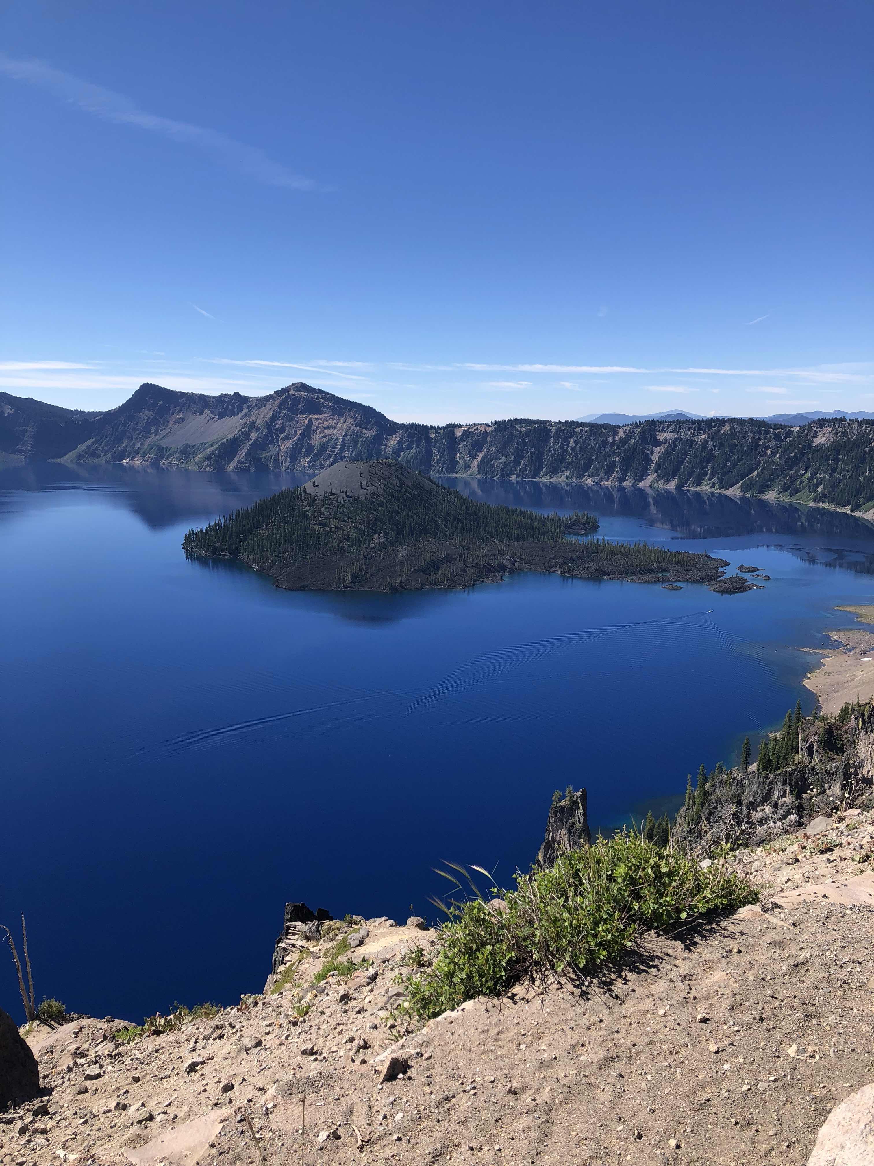
So I finally got the courage to head back out into the mosquitos and made it up to the top of Maiden peak.


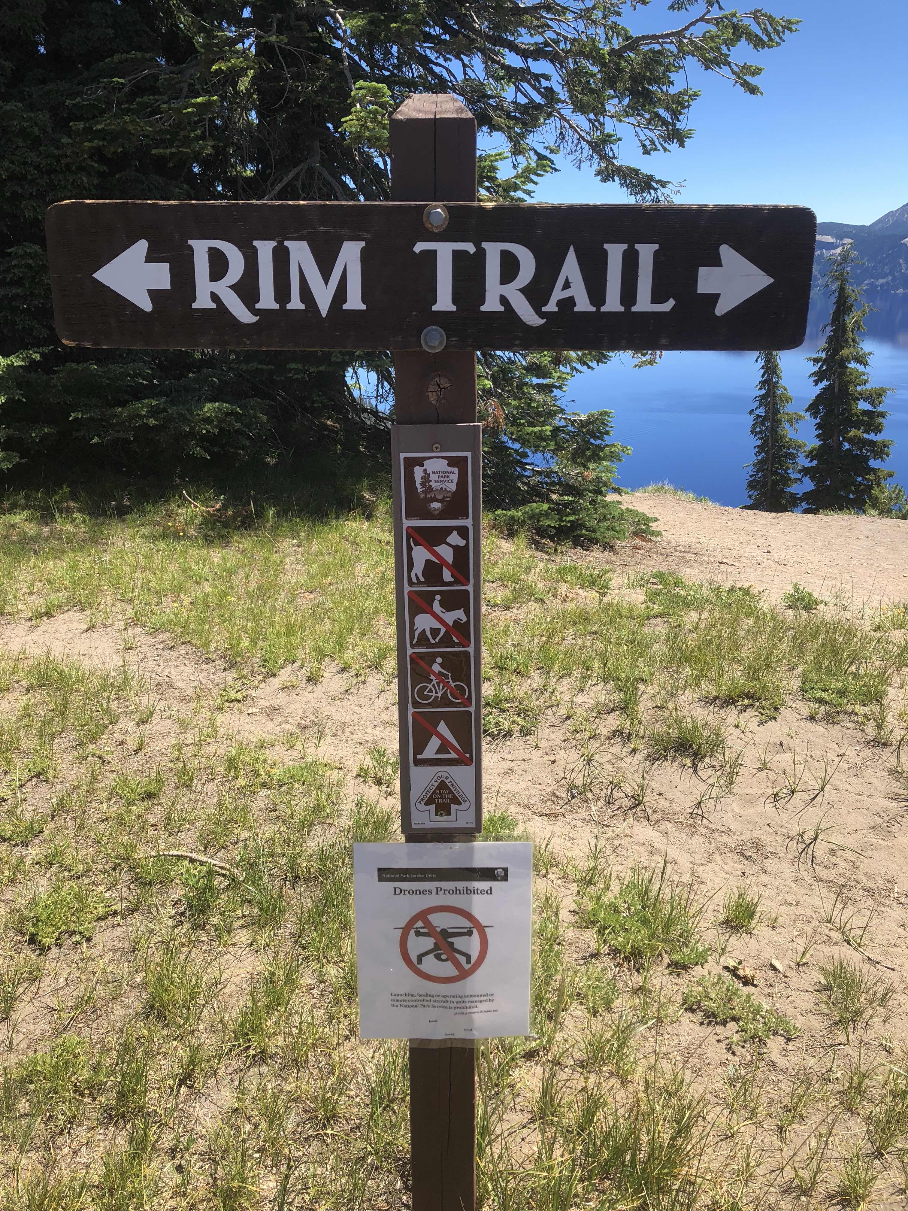
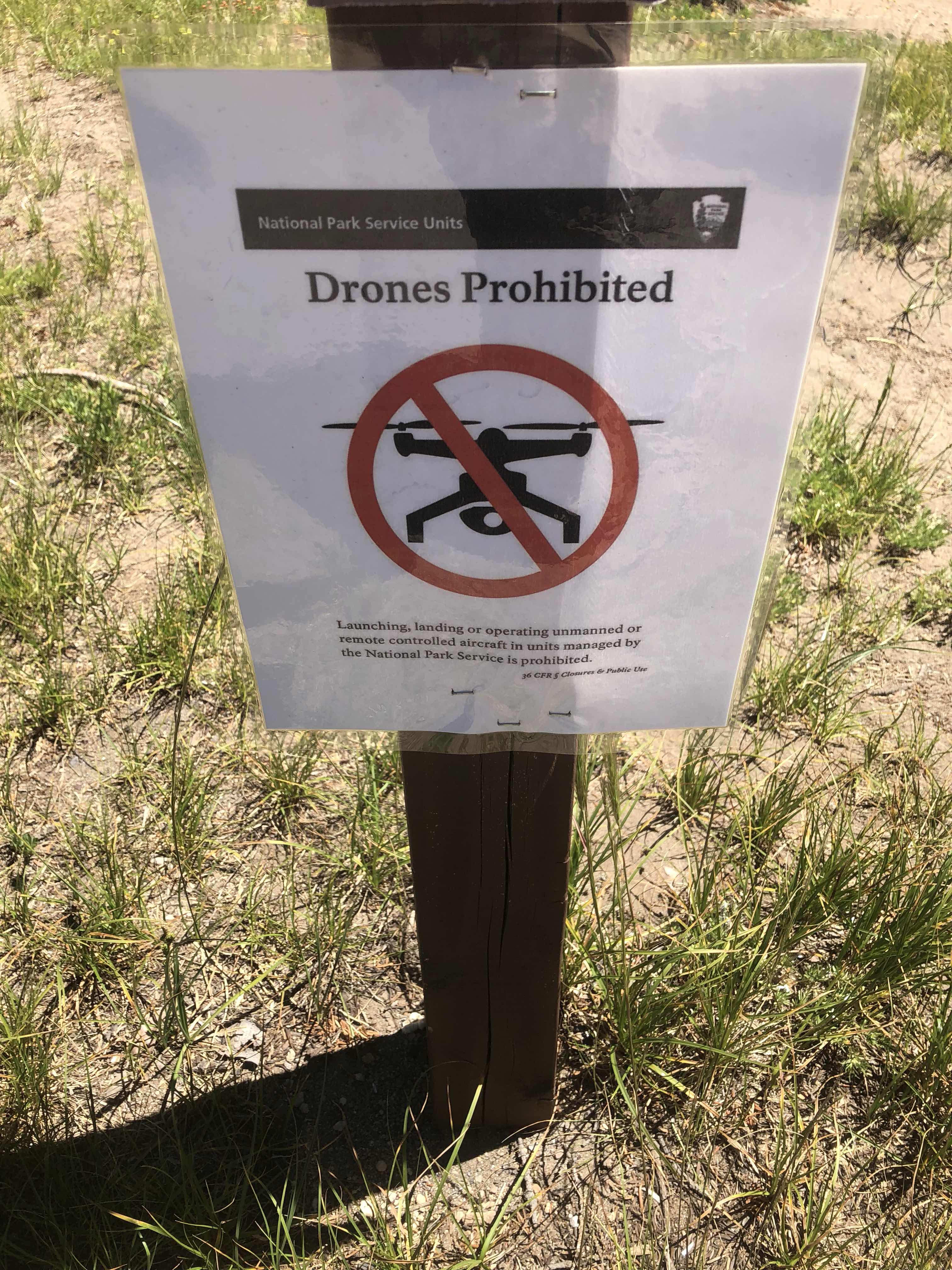
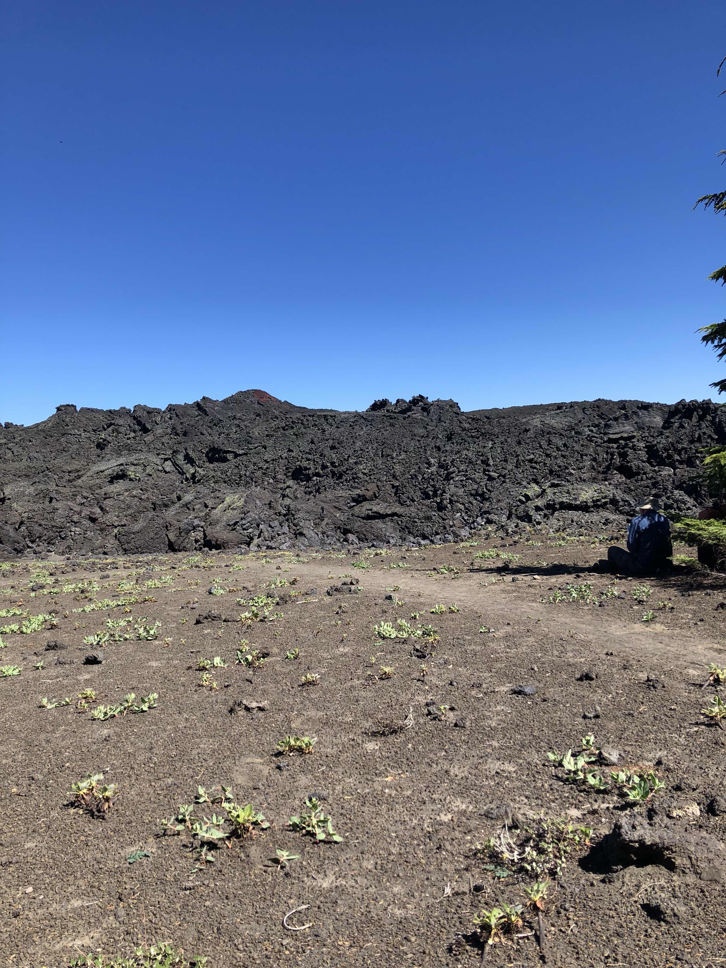
Now that the rest of the day was all downhill, I put on the afterburners to try to get to Shelter Cove as fast as possible.  I did come across this interesting signage at a junction however, not really screwing me up but making me laugh:


Finally made it down to Willamette Pass and made it the 2 additional miles into Shelter Cove Resort.


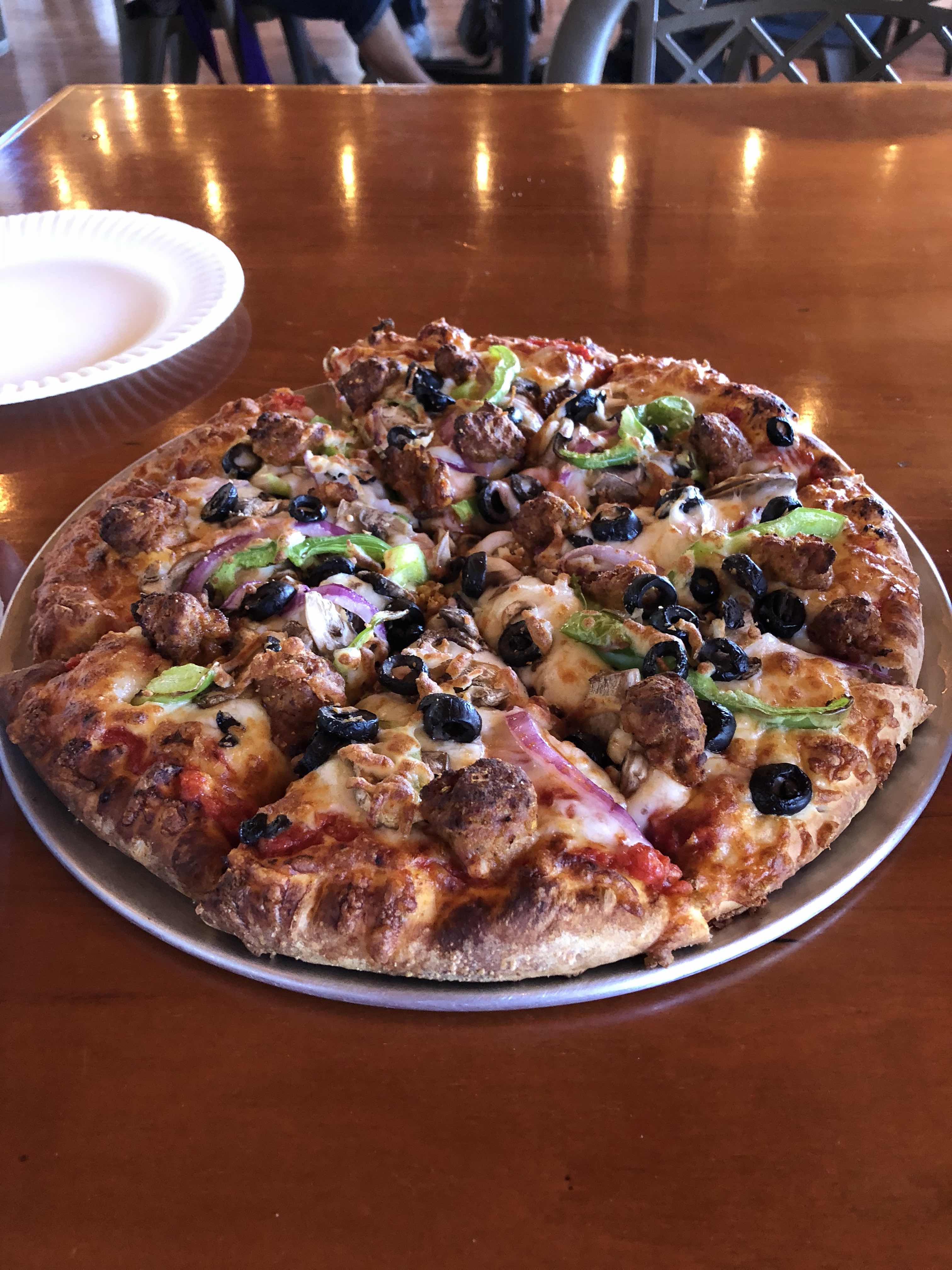
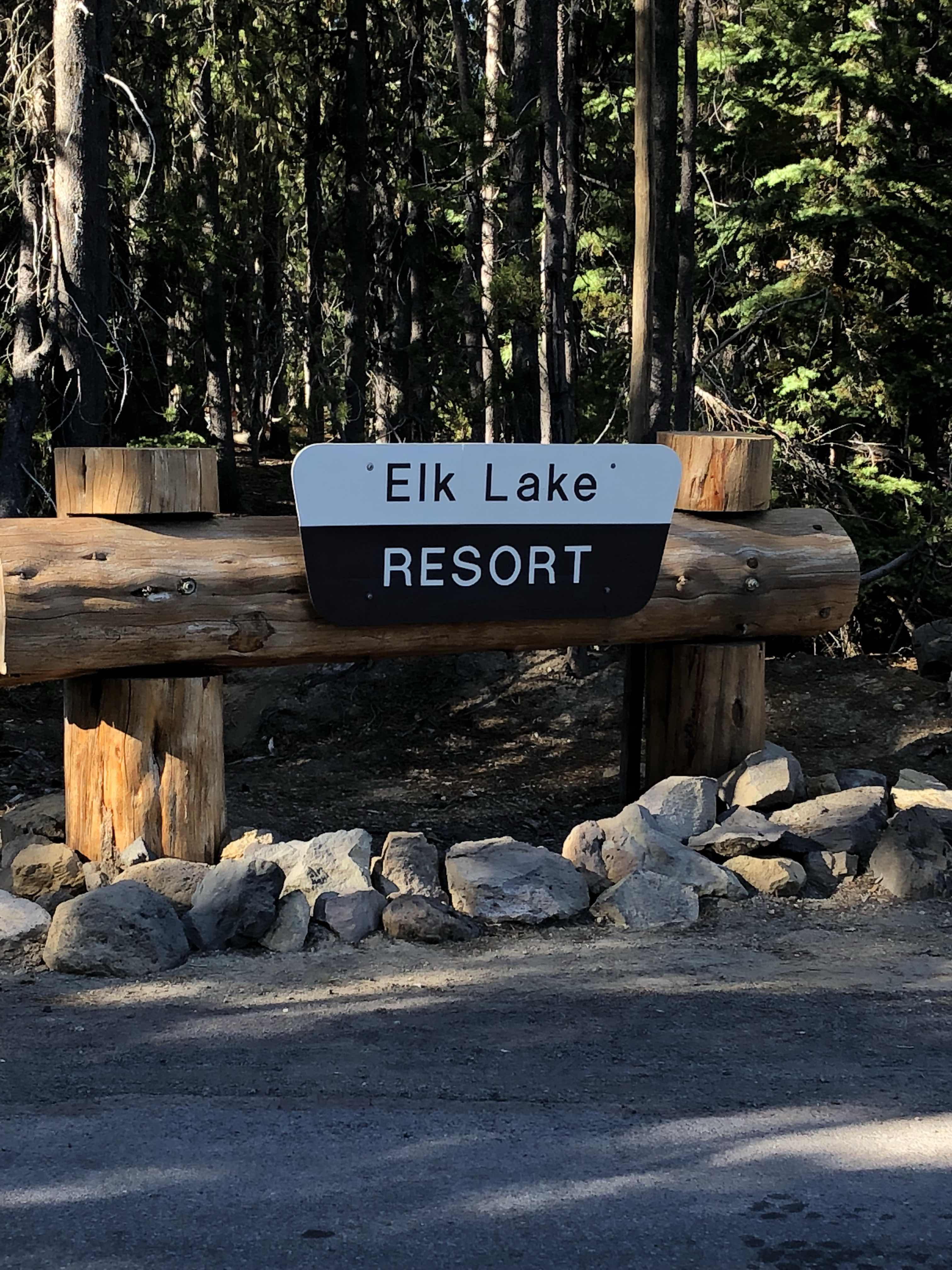
I forgot to take any pictures of the actual resort but it seemed a little bigger than Elk Lake, and definitely a lot more hiker friendly.  Same kinda place though.  Large car camping resort on a lake with a marina.  It is Saturday, so they actually had some sort of big fishing competition on the lake today, so it was pretty packed.  I headed right into the restaurant/food pickup area and got myself a large fountain root beer for $1, followed by another, followed by another.  Only then did I go in the store and pickup my resupply box.  It did cost $5 per box to pick up, which I guess I understand for their inconvenience of storing all the boxes and keeping them organized enough to find each box specifically.  Just think about it.  Lets say 2000 hikers come through here a summer and half (though its probably a lot more) send themselves a box here, thats $5000 they are making each summer just off of having mail delivered to them and keeping the boxes organized.  Crazy.

The store was decently stocked though still a bit over priced.  Alas they did not have any dayquil or nyquil for my head cold/cough.  I had run out yesterday and though I’m feeling better it is still lingering.  I paid the $11 to camp again though I could have camped a quarter mile away for free if I wanted to, it was just easier this way.  Then came one of the best parts of my hike so far.  I got to sit and hang out with all the northbound hikers.  I was finally in a setting where I could talk to other hikers, share stories, joke around, and talk about the trail.  I really hadn’t realized how much I had missed it this last week.  Going southbound can be a very lonely experience at times.  

I went and set up my tent and came back to the picnic tables all the hikers were congregating at.  There were about 10 of us total.  They were all starting to order dinner and get some beers.  I decided to have one beer and hang out before I headed over to the back to back buildings that housed the laundry and the showers.  Laundry was $1.50 each for wash/dry/detergent.  The showers were pay showers based on a timer.  $2/3 minutes.  I splurged on 9 total minutes.  It might not seem like that long, but its an eternity when you haven’t felt hot water in a week.

The other cool thing Shelter Cove had was a separate tent set up just for PCT hikers with multiple hiker boxes where you could throw unwanted items or food into and others could come along and pick through what they wanted, and a full on charging station which was lined with hikers phones and battery packs trying to get every last bit of juice in them before they headed back into the woods.  I had plugged both my phone and power bank in before I set up my tent, and though I didn’t expect to get too much in the bank, the phone was already back to near full.

The store had wifi, but unfortunately I had no AT&T service.  The wifi was dreadfully slow too.  I was able to get out an imessage to my brother to let him know where I was and to tell my family.  And I was able to get one out to my cousin to let him know I was still on track to get back to Ashland around the 25th-26th.  Speaking of Ashland, I checked the status of the fire and it is now 90% contained, still without touching the trail.  Hopefully it will be at 100% any day soon now.  

Unfortunately the wifi didn’t have enough juice to let me upload these blog posts.  After this I will have 6 of them just sitting here on my phone waiting to get service to upload.  I couldn’t even get a proper facebook message out with pictures.  The first time I tried with 14 pictures, and it timed out.  The second time I tried with 4 pictures, it timed out.  Finally I had to just type an update with no pictures to get it to go through.

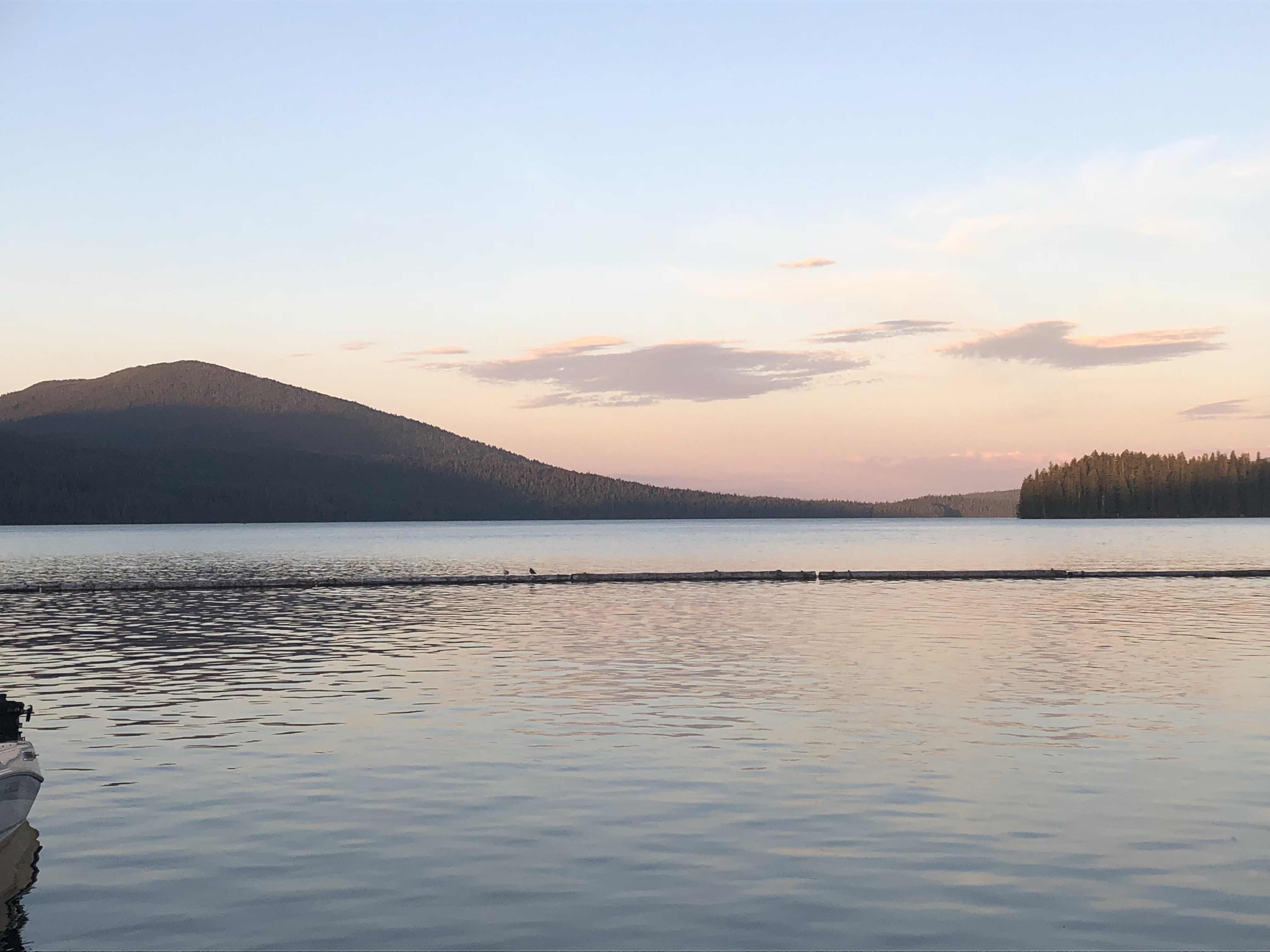
Now that all my business was done (I will go through my food and resupply box tomorrow morning) I was able to have a couple more beers and got the hiker special at the grill.  4 ribs, french fries, cole slaw, and baked beans for $10.  Well worth the price.  As the sun set over the marina I was able to get this shot:


I’m gonna take my time getting out of here tomorrow morning.  Usually I try to do a zero day about every 100-150 miles hiked.  I’m starting this trip planning on doing 280+ miles before I give myself any, so short days in and short days out (neros) are gonna be very important going forwards.

Heres to the first roughly 100 miles and the 800+ more to go!!!

Keep on keeping on

- Patch


7/13/18 - Day 5 - Stormy Lake to Bobby Lake

Daily Miles: 18.0
Total Miles This Hike: 101.6
PCT Miles Covered: 1799.8

Every time I woke up throughout the night all I could hear was the buzzing of mosquitos outside my tent.  They usually die down in the middle of the night, but apparently not here.  When I finally looked outside the mesh I saw about 50 of them attached to the outside of my tent.  This was probably the fastest I have left camp in my life.  Out of the tent, packed up and walking within about 15 minutes, no breakfast.  

I did luck out to an extent today though.  About 5 miles in, I had just filled up water at Irish Lake, and a couple hikers were coming northbound and told me that I wouldn’t need the headnet for a couple miles, though it would be hot.  The next stretch was through a very recent burn area fully exposed climbing about 1000 feet over 4 miles.  Normally this would really suck, but just not having to wear the bug net made it a bit better.  Once I got through the burn area I sat down for a break and met another northbound female hiker who stopped and hung out with me for a bit.  It was nice to actually have a conversation with somebody on trail because since the couple of people I saw the first day going southbound, I haven’t seen any others going that direction, and most northbounders don’t stop long enough to talk.  We compared notes on upcoming sections including water and bugs, and she reminded me of a common phrase I used many times in previous hikes.  “Never trust a southbounder.”  I laughed when she said it, because now for the first time I was the southbounder.  After about 20 minutes, we parted ways, but it was nice to have some conversation.

A little ways after that I crossed a forest service road and was surprised with another cooler.  


I wondered why the girl I met hadn’t mentioned it, but then I opened it and knew why.  It was empty.  Sometimes an empty cooler is worse than going a long time seeing no trail magic.  I don’t hope or depend on it, but the rise in spirits in seeing something like this is ultimately a morale crusher when it’s proven to be empty.

I wanted to get as far as I could today so I would have a shorter walk into Shelter Cove tomorrow for rest and resupply.  My minimal goal was Bobby Lake, but after last night I was nervous camping by a lake again because of the mosquitos, so my ultimate goal was to get water at Bobby Lake and head uphill about another 3.5 miles and 800ft to the Maiden Peak Ski Shelter.  The day just kept getting hotter, and my head cold had turned into just a bit of a cough that I just couldn’t kick, so I decided to just wait till I got to Bobby Lake and check the mosquito status.  

When I got to Bobby Lake the mosquitos were significantly less than the night before, so I decided to just stay and push up the hill first thing in the morning.  2 other female hikers came in with a dog after I set up camp but they moved a ways around the lake so once again (as is the norm right now) I was camping alone.  

In addition to the cough I have started to develop 2 blisters on my left foot, so tonight after I was done filtering and eating, I soaked my feet in the lake and will be ready to “patch” them up tomorrow morning.  Shelter Cove tomorrow and my first resupply along with real food, a shower, and laundry.  All very much needed.

Keep on keeping on

- Patch

7/12/18 - Day 4 - Elk Lake Resort to Stormy Lake

Daily Miles: 18.6
Total Miles This Hike: 83.6
PCT Miles Covered: 1782.1

I actually slept pretty decently last night even though I think I sweat out a ton of water dealing with this cold.  The dayquil seems to have helped a bit as I feel about 75% better than I did yesterday at this time.  I still contemplated staying and taking a zero, but I also felt well enough to at least get some miles in today as overall today didn’t have too many big ascents or decents.  

I left Elk Lake around 8:30 and made my way back to the trail.  This section was pretty easy grade almost all of the day.  It is easy to see why certain sections of Oregon you can make big miles under normal conditions.  The normal conditions I am referring to are early to mid August when most thruhikers come through here.  Not in mid July with the mosquito phenomenon.  

About 3 miles out of camp I saw running water in a stream.  Didn’t see any the rest of the day as my water has started to come solely from lakes and ponds.  The mosquitos though don’t give you a minute of reprieve whether it is taking a food break, getting water, or going to the bathroom.

About halfway through the day I came upon this old school PCT marker on a tree where the tree has actually grown around the marker.  Pretty cool.


As the day progressed, I actually made it farther than I expected and tried to aim towards Stormy Lake as my camping spot for the day.  Big mistake.  Don’t know why some of these lakes have bigger mosquito populations than others, but this one was near the saturation point.  Not exaggerating, thousands of mosquitos had me in their sights, no matter how much deet I had, or covered skin.  They would find their way through.  I set my tent up as fast as possible, filtered water cooked my food and ate in my tent (only after having killed the 50+ of them that got into it while I had the zipper open for about a minute.  

All I could think about while falling asleep was hoping the swarm was less tomorrow morning.

Keep on keeping on

- Patch

7/11/18 - Day 3 - Hinton Creek to Elk Lake Resort

Daily Miles: 13.3
Total Miles This Hike: 65.0
PCT Miles Covered: 1764.8

Sleep was difficult last night as I seem to be developing a head cold of some kind.  I was coughing all night and when I sat up this morning had head congestion, a slight sore throat and a bit of post nasal drip.  I must have picked up something in town the last couple days before I started hiking.  The good news is I was headed to some semblance of civilization today at Elk Lake Resort.  Everything I read says their camp store is minimal, but hopefully they have some dayquil or nyquil equivalent.  The other good news is that after a small up, most of the rest of the day is down so it won’t be too strenuous.

The lure of real food and drinks is there already as I was able to be out of camp by 7:30AM.  Hiking is so much better in the cool morning air before the bugs get too prevelant.  But by 10AM they were back in droves and my headnet stayed on for most of the rest of the day.  During the ascent, I had about a 2 mile stretch through an open meadow where you could see the trail about a mile ahead.


Around 11:30 I hit a great breaking spot at the top of my last ascent overlooking Mt. Bachelor before it was all down for the next 4 miles to the Elk Lake junction. I stopped for another break there around 1PM at which point I was swarmed in butterflies.  A few grew attached to the salt on my pack to the point I had to physically shoo them off of it when I got up to leave.


Another mile and a half and I was into the Elk Lake Resort. Your classic touristy lake resort with boat launch, mini marina, a campgrounds, and a lodge with a small store and restaurant.


Miraculously the store had 2 bottles of dayquil left.  Would have only bought one but I think the clerk mischarged me for only $3, so I bought the second one too.  I got a camping spot, then came back and sat in the restaurant drinking Mr. Pibb and eating a ceaser salad and an order of wings.  Kind of an odd craving as far as food goes but it worked.  I was able to charge my phone and charger a little bit before I called home.  Unfortunately cell coverage was still only 2 bars and I couldn’t upload blog posts.  Anybody actually reading these are going to be hit with a giant dump of posts when I get enough service.  

Around 6:45 I headed back to the campground to turn in early and pump myself full of more dayquil.  Hopefully I feel a bit better tomorrow.  I don’t want to zero already, but will if I think its my best move to getting better.

Keep on keeping on,

- Patch


7/10/18 - Day 2 - Lava Lake Camp to Hinton Creek

Daily Miles: 17.15
Total Miles This Hike: 51.7
PCT Miles Covered: 1753.0

Well, I was awake in the tent at 5:30AM.  I think once I get into a routine I will be able to get out by 7AM everyday, but today that was not the case.  I knew my feet were gonna need to be attended to before I left, and I layed in the tent procrastinating about getting up till around 7:30.  Quick check of camp and everything seemed normal, including the bear cannister undisturbed where I left it the night before.  As I knew I would, one day in and I was regretting bringing the bear cannister on this section.  Most thruhikers only carry these cannisters through certain sections of California where they are required and send them back home the first chance they get to save the roughly 2 extra pounds they weigh.  I knew better than to bring it for weight purposes, but I figured I would start with it because I knew I would be far ahead of the pack of thruhikers, and didn’t know how much use this part of the trail got otherwise.  I didn’t want to be a bears only target for miles without one.  Based on what I have seen so far, there is plenty of use here in Oregon, and the can will be going home first chance I get.  

After a quick chat with a woman in the site next to mine who was also going south with her daughter, I finally packed everything up and headed south.  Most of today was uphill, but I didn’t have to worry about water today as I passed many great sources.  Though I did still go through some burned areas they weren’t as long or prevelant as yesterday.  I also had to maneuver through a few more small patches of lava rocks as I made it up to just shy of 7000ft.


After reaching my highest elevation of the day I slowly started to get into lower elevations, including walking by Obsidian Falls which is about a 50 foot waterfall that cascades over a shelf of pure obsidian.


Day 2 is usually one of the hardest days because your body is very sore in muscles you didn’t know you had as a result of Day 1.  I did feel like I was dragging a bit but managed to make it 17.1 miles which is a Day 2 record for me in all my hikes.  Camping spot for tonight was between the trail and Hinton Creek.  So far I have been in higher elevated exposed areas so the mosquitos weren’t that bad.  Here they were downright obnoxious.  Cooked dinner covered in deet and a headnet but had to eat it in my tent, because it was physically impossible to take the headnet off without getting bit repeatedly.  Oregon is pretty nasty with mosquitos from what I hear, so the next couple weeks should be interesting...tomorrow into Elk Lake Resort...

Keep on keeping on,

- Patch

7/9/18 - Day 1 - Santiam Pass to Lava Lake Camp

Daily Miles: 18.65
Total Miles This Hike: 35.55
PCT Miles Covered: 1736.1

I have FINALLY started hiking, though I might have picked a difficult spot to start.  I knew I had to be up very early today so last night before bed, I actually moved everything outside out of the bunkroom and set up in one of the hammocks they had in the back yard.  This way I could get up without disturbing anybody.  I was up at 5:15AM and was walking to the bus station by 6AM.  Got some Starbucks on the way (last chance for coffee for a while), and made it on the 6:40AM bus to Sisters, which is the next town up.  The bus lets you off near a McDonalds so I figured I would grab some food as well, and by 8:15AM I was by the side of the road with my thumb out.  Only took about 10 minutes until a car with two older women pulled over.  They said they could only bring me half way to the trail but I still took it.  After getting out of the car it took about 5 minutes for a guy named Kenny to pick me up blasting Jimmy Buffet in his pickup truck.  He was a very energetic older hippie, and even offered me weed for my hike which I politely turned down. Slowly we made it up the hill and when the road hit its apex there is was.  The Pacific Crest Trail at Santiam Pass.  Nearly 300 miles north of where I expected to start, but that didn’t matter.  I was finally here.


This section of Oregon has some big mountains, but the trail somewhat skirts them all as it winds its way north through the state.  I was headed south though.  Pack on, and I was walking.  The first 5 miles were relatively flat but the mosquitos were already out, so it wasn’t completely smooth sailing.  About 5 miles in I hit the trail into Big Lake Youth Camp.  A kids camp that you can send resupplies to, get water at, or even get a free meal (for a donation) if you hit it at the right time.  I saw no need in going in as I just started my hike.  The next section (rest of the day) was through a burn area from a previous fire.  In the last couple years there have been so many fire closures on the PCT in Oregon that I wonder how many of these I’m gonna have to walk through.


About 10 miles into the day, fully exposed I had to start conserving water.  This was a long waterless stretch except for Big Lake Youth Camp which I had passed up.  After the burn zone I then came to the lava beds.  This whole area of the Cascades are made up of dormant volcanos, and in many spots you will see where the lava flowed downhill hundreds or thousands of years ago and made these veins of igneous rock.


Nothing grows in these areas because there is no soil, just rock.  Despite more time being at full exposure to the sun, the walk through the lava beds at least allowed for some breathtaking panoramas.


I literally had a quarter of a liter of water when I got to MacKenzie Pass which is the other road out of Sisters.  I flirted with the idea of hitching into town to just get something to drink and hitching back out, however in just 1 more mile I would get to my first real water source, and a staple that we hikers live on here in Oregon: Pond and Lake water.  Yum.  Actually with a filter giving me piece of mind that I’m not gonna get girardia, some of these ponds taste better than water out of the tap.


On the way into this “Lake” however, my prayers were answered in the form of my first trail magic on my first day.  


Lava Lake Camp is a campground accessible to cars, and somebody had left a whole bunch of gatorades on the trail into the lake for PCT hikers.  Finally hydrated between the gatorade and the lake water, I set up camp and was ready to pass out.  The lava walking had my feet a bit torn up and I will have to monitor them tomorrow, and the sunburn hurt like all hell as I tried to lay down.  I don’t care though because I am back out here finally...

Keep on keeping on

Patch